
Discover
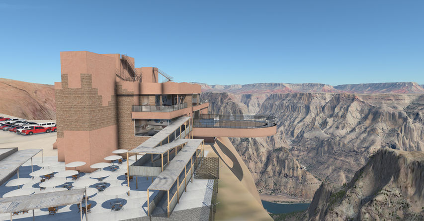
Welcome to Grand Canyon West! Located 60 miles from Peach Springs Arizona, 1G4 Grand Canyon West sits atop the south rim of the Grand Canyon. When on approach for runway 35, below you is the Colorado River snaking through the Grand Canyon, to the right is Guano Point and the old tramway, and to the left is the famous Grand Canyon Skywalk, a glass bridge that extends over 60 feet over the Grand Canyon. The approach for runway 17 is equally scenic with the Cabins at Grand Canyon West as well as a historic western town to your right, and directly ahead, a clear, stunning view of the Grand Canyon.
1G4 - Grand Canyon West is a detailed beautiful recreation of the real airport for X-Plane. In addition, the famous Grand Canyon Skywalk, Guano Point and the old tramway, and the Cabins at Grand Canyon West as well as the historic western town are all included. In addition, a 30m Ortho4XP mesh with ZL16 NAIP imagery that has had most major shadows removed from the imagery is included covering roughly 40% of the Grand Canyon.
Features
Detailed rendition of 1G4 – Grand Canyon West:
-
All buildings feature ultra high resolution textures.
-
All buildings feature advanced PBR normal maps for realistic reflections and bump mapping.
-
All buildings are highly detailed, down to even door handles.
-
Most buildings feature "lite" interiors to give windows more depth.
-
Large scale realistic ground textures with high frequency tiled normal maps for detail.
-
All models optimized for maximum performance.
Living scenery:
-
Integration with X-Plane 12 weather effects
-
Ground equipment automatically serves your aircraft upon request.
Local Landmarks
-
Detailed rendition of the famous Grand Canyon Skywalk.
-
Detailed rendition of Guano Point and the old tramway
-
Detailed rendition of the Cabins at Grand Canyon West.
Custom surroundings
-
30m mesh surrounding the airport covering roughly 40% of the Grand Canyon (+36-114/+35-114)
-
ZL16 USGS NAIP Orthoimagery is used for both ortho tiles.
-
Nearly all ugly shadows removed from Orthoimagery for a clean realistic view of the canyon.
-
Forests procedurally placed from ortho show X-Plane 12 3d vegetation in the correct areas, and nowhere else.
-
Alpilotx’s UHD Mesh V4 provides all other overlay elements (used with his permission).


